Carthographic Models
table of contents
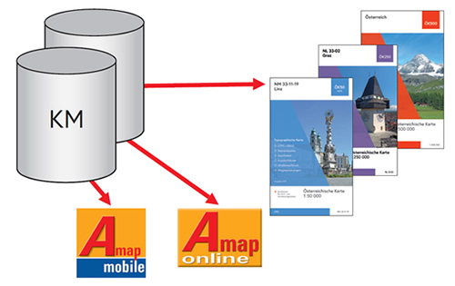
The BEV maintains the extensive information content of the national topographic survey, generalized and scale-dependent, in digital form as Cartographic Models (KM). These form the basis for the official cartographic products.
Cartographic Models - Raster present the content of the map as square pixels. Cartographic Model - Vector store the individual objects as points, lines or areas and have additional value as they assign different attributes.
The nationwide coverage, uniformity and the guaranteed periodical up-dating have special advantages for the user.
Products
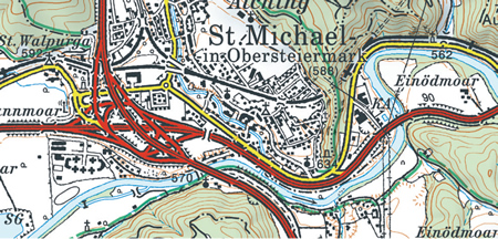
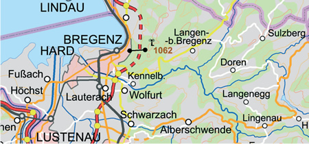
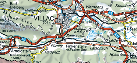
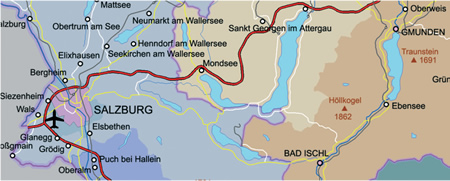
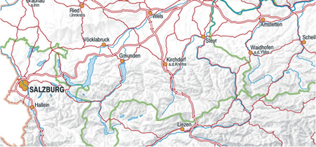
Cartographic Model 1:50 000 - Raster (KM50-R)
The Cartographic Model 1:50 000 - Raster (KM50-R) is the digital image of the Austrian territory and the
adjacent foreign territories in the scale 1:50 000.
It is divided as follows:
- Situation
- Contour Lines
- Hydrography
- Forest
- Thematic Overprints
- Hill shading
The KM50-R forms the basis for the national Austrian Map 1:50 000 (ÖK50) - in cooperation with the Ministry of Defence - as well as for the Austrian Map 1:25 000 (ÖK25V - enlargement of the ÖK50).
Updating
They are updated nationwide in regular intervals of 6 years (up to FAKT 2013) and 3 years (as of FAKT 2014) but also if required by important changes of the infrastructure (Continuous Updating). The 191 sheets are revised in accordance with the UTM sheet system (12` by 20`).
Sheets along the boundary with areas of foreign territory are completed if possible with the original data of the respective countries (e.g. Germany, Switzerland, and Czech Republic).
After every second nationwide updating (6 years) of a sheet area a new Austrian Map 1:50 000 is printed.
Delivery
The KM50-R is delivered:
- Georeferenced
- As combined color file
- Single files divided into layers (according to topics)
- In the sheet layout of the national series of scales
- In random sections
- In different resolutions
- In different data formats
| Topic | Layers |
|---|---|
| Situation | Situation, national, federal, municipal boundaries, military training area, national park |
| Contour lines | Contour lines, rocks |
| Hydrography | Lines, font, shading for waters, layers, structure and names of glaciers |
| Forest | Forest areas |
| Imprint | Hospitals and pharmacies, path markings, street overprint red (highways and expressway), street overprint orange (main connections), street overprint yellow (important secondary roads) |
| Hill shading | Hill shading |
Cartographic Model 1:50 000 - Vector (KM50-V)
The Cartographic Model 1:50 000 - Vector (KM50-V) includes the contour lines including their heights as attributes as well as the forest information in vector form of the Cartographic Model 1:50 000 - Raster.
Updating
The continuation of the forest areas and the contour lines goes hand in hand with the continuous and nationwide updating of the KM50-R.
Exception:
The KM50-V contour lines comprise no data from Switzerland and Germany.
Delivery
The KM50-V is delivered:
- Georeferenced
- Layers split
- In the sheet layout of the national series of scales
- In random sections
Cartographic Model 1:250 000 - Vector (KM250-V)
The Cartographic Model 1:250 000 - Vector (KM250-V) is the digital image of the Austrian territory in the scale 1:250 000.
It is divided into the following object ranges:
- Transportation
- Hydrography
- Administrative Boundaries
- Settlements
- Contour lines
- Land cover
- Individual Objects
- Geographical Names
The Austrian share of the pan-European topographic reference data EuroRegionalMap (ERM) is derived from these data. Coordinated by Eurogeographics the national surveying authorities create the ERM seamless for all of Europe. It forms a Europe-wide harmonized topographic reference data set in the scale 1:250 000.
The KM250-V forms the basis for the national Austrian Map 1:250 000 (ÖK250) which is derived and published every 3 years in cooperation with the Ministry of Defence.
Updating
The content of the KM250-V is updated continuously, the data for the free-of-charge delivery are provided twice a year.
Delivery
The KM250-V is delivered:
- Georeferenced
- Entire area of Austria
- Layers split, divided into object ranges
- Data format Shape
Cartographic Model 1:250 000 - Raster (KM250-R)
The Cartographic Model 1:250 000 - Raster (KM250-R) is the symbolized and finally rastered image of the KM250-V.
The KM250-R consists of the following topics:
| Topic | Layers |
| Situation | Situation, font, boundary lines of the political boundaries, national park, military training area |
| Contour lines | Contour lines, height numbers (spot height), rocks |
| Hydrography | Lines, font, shading for waters, layers and names of glaciers |
| Forest | Forest areas |
| Imprint | Street overprint red (highways and expressway), street overprint orange (main connections), street overprint yellow (important secondary roads), hospitals |
| Hill shading | Hill shading |
Updating
Based on the KM250-V the KM250-R is updated continuously. The data for the free-of-charge delivery are provided twice a year.
Delivery
The KM250-R is delivered:
- Georeferenced
- As combined color file
- Single files divided into layers
- In tiles 100 x 100 km
- Resolution 508 dpi
- Data format TIFF
Cartographic Model 1:500 000 - Vector (KM500-V)
The Cartographic Model 1:500 000 - Vector (KM500-V) is the digital image of the Austrian territory in the scale 1:500 000.
The KM500-V is divided into the following object ranges:
- Land cover
- Contour lines
- Hydrography
- Boundaries (national, provinces and district)
- Settlements (signatures and geographical names)
- Transport
The KM500-V forms the basis for the national Austrian Map 1:500 000 (ÖK500) which is derived and published every 3 years in cooperation with the Ministry of Defence.
Updating
The KM500-V is updated continuously based on relevant information about changes. All very important changes are implemented as soon as they are finished in nature. The data for the free-of-charge delivery are provided twice a year.
Delivery
The KM500-V is delivered:
- Georeferenced
- Entire area of Austria
- Layers split, divided into object ranges
- Data format Shape
The Cartographic Model 1:500 000 - Raster (KM500-R) is the symbolized and afterwards rastered image of the KM500-V.
The KM500-R consists of the following topics:
| Topic | Layers |
| Situation | Situation and area representation of municipalities > 10 000 inhabitants, boundary lines (national and federalboundaries), national park boundaries |
| Contour lines | Contour lines, rocks |
| Hydrography | Lines, font, shading for waters, areas and names of glaciers |
| Forest | Forest areas |
| Imprint | Street overprint red (highways and expressway), street overprint orange (main connections), street overprint yellow (important secondary roads) |
| Hill shading | Hill shading |
Updating
The KM500-R is updated continuously. The data for the free-of-charge delivery are provided twice a year.
Delivery
The KM500-R is delivered:
- Georeferenced
- As combined color file
- Single files divided into layers
- Entire area of Austria
- Resolution 508 dpi
- Data format TIFF
Cartographic Model 1:1 000 000 - Vector (KM1000-V)
The Cartographic Model 1:1 000 000 - Vector (KM1000-V) is the digital image of the Austrian territory in the scale 1:1 000 000.
The KM1000-V is divided into the following object ranges:
- Transportation
- Hydrography
- Settlements
- National Boundary
- Administrative Boundaries (to administrative district)
- Geographical Names
Updating
The data are updated annually based on the KM500-V and delivered free-of-charge.
Delivery
- Georeferenced
- Entire area of Austria
- Single Layers
- Data format Shape
Cartographic Model 1:2 000 000 - Raster (KM2000-R)
The KM2000-R is a digital overview of Austria with the following topographic information that is important for orientation:
- Transportation
- Hydrography
- Settlements
- National Boundary
- Administrative Boundaries (to administrative district)
- Hill shading
Updating
The KM2000-R is updated annually and delivered free-of-charge.
Delivery
- Georeferenced
- As combined color file
- Entire area of Austria
- Data format TIFF
Standard Charges
Cartographic Model 1:50 000 Raster
| KM50-R | Price in € per km² |
|---|---|
| Resolution 400 l/cm in layers - all layers | 0,30 |
| Resolution 200 l/cm in layers - all layers | 0,100 |
| Resolution 100 l/cm in layers - all layers | 0,050 |
| Resolution 400 l/cm color (all layers incl. hill shading) | 0,150 |
| Resolution 200 l/cm color (all layers incl. hill shading) | 0,050 |
| Resolution 100 l/cm color (all layers incl. hill shading) | 0,025 |
| KM50-R Hill shading | Price in per km² |
| Resolution 200 l/cm | 0,040 |
KM50-R select
For single topics (summary of layers) see rate below, this is only possible for delivery per layer:
| Situation | 50 % |
| Contour lines | 20 % |
| Hydrography | 15 % |
| Forest | 10 % |
| Thematic Overprint | 5 % |
Cartographic Modell 1:250 000 Raster
| KM250-R | Price in € |
|---|---|
| Entire area of Austria | free-of-charge |
Cartographic Model 1:500 000 Raster
| KM500-R | Price in € |
|---|---|
| Entire area of Austria | free-of-charge |
Cartographic Model 1:2 000 000 Raster
| KM2000-R | Price in € |
|---|---|
| Entire area of Austria | free-of-charge |
Cartographic Model 1:50 000 Vector
| KM50-V | Price in € per km² |
|---|---|
| Forest | 0,03 |
| Contour lines (Graphics with height attributes) | 0,12 |
Cartographic Model 1:250 000 Vector
| KM250-V | Price in € |
|---|---|
| Entire area of Austria | free-of-charge |
Cartographic Model 1:500 000 Vector
| KM500-V | Price in € |
|---|---|
| Entire area of Austria | free-of-charge |
Cartographic Model 1:1 000 000 Vector
| KM1000-V | Price in € |
|---|---|
| Entire area of Austria | free-of-charge |
Information as of September 2019
All rights to change the Standard Charges reserved.
General Terms and Conditions
The terms of delivery and payment as well as the copyright notice are set out in the current Terms and Licensing Conditions of the BEV.
Standard Charges and Licensing Conditions
The price and licensing conditions for the products of the BEV are regulated in the "Standard Charges and Licensing Conditions of the BEV". The current version is published in the "Amtsblatt für Vermessungswesen" (official journal for surveying) and can be found on www.bev.gv.at.
Projection
The Cartographic Models are produced as follows:
| Model | Reference system | Map projection |
|---|---|---|
| KM50-R | ETRS89 | UTM |
| KM50-V | ETRS89 | UTM |
| KM250-V | ETRS89 | UTM |
| KM250-R | ETRS89 | UTM |
| KM500-V | ETRS89 | Lambert |
| KM500-R | ETRS89 | Lambert |
| KM1000-V | ETRS89 | Lambert |
| KM2000-R | ETRS89 | Lambert |
Heights refer to the vertical datum in Trieste/Italy.
The products KM50-R and KM50-V are also available in other coordinate systems:
| Reference system | Map projection | Ellipsoid | Ellipsoid | Height system |
|---|---|---|---|---|
| MGI Gauß-Krüger | Gauß-Krüger | Bessel 1841 | MGI | Adria Triest |
| MGI - Lambert | Lambert | Bessel 1841 | MGI | Adria Triest |
| ETRS89 - Lambert | Lambert | GRS80 | ETRS89 | Adria Triest |
All other products of the Cartographic Models are available only in the predefined projections.
Potential Applications
The data of the Cartographic Models are particularly suited as spatial reference basis and as basic information for the linkage of subject specific data as well as the intersection with thematic information and their analysis due to their high accuracy and the different scales available.
Cartographic Models are an essential basis for e.g.:
- Geoinformation systems
- Thematic representations
- The updating of existing data
- Start screens for WEB-Portals
- The derivation of cartographic products
- Printed maps
The data of the Cartographic Models are used in many fields such as:
- Transportation
- Agriculture and forestry
- Environmental protection
- Civil protection
- Crises management
- Regional management and planning
- Water management
- Energy supply
- National defense
- Geology
- Tourism