Remote Sensing
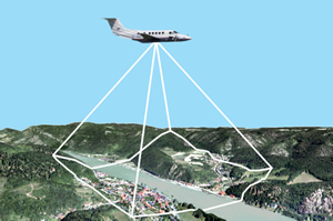
Remote Sensing is the sum of all processes of compiling information about the surface of the earth without making physical contact and the subsequent evaluation and processing of the data. At the BEV we mainly use methods that make use of the evaluation of aerial image information. The tasks of the BEV in the field of remote sensing comprise:
- Procurement of remote sensing data, especially digital aerial images and orthoimages
- Classification and analysis of remote sensing data
- Provision and updating of the digital terrain model
- Development of digital surface models
- Production of derived products from digital remote sensing data and the digital terrain model
- Maintenance of the remote sensing data archive and derived products
- Digitising analogous archive data
This results in a multitude of product offers of aerial images, metadata, orthoimages and digital height models (terrain model and surface model).