Cartographic Models
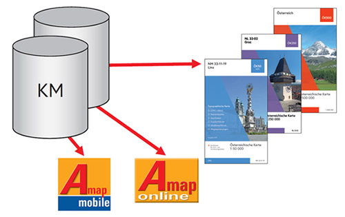
The BEV maintains the extensive information content of the national topographic survey, generalized and scale-dependent, in digital form as Cartographic Models (KM). These form the basis for the official cartographic products.
The Cartographic Models were initially created by digitizing the analogue national maps and hence were developed as raster or vector models.
Cartographic Models - Raster present the content of the map as square pixels. Cartographic Model - Vector store the individual objects as points, lines or areas and have additional value as they assign different attributes.
The nationwide coverage, uniformity and the guaranteed periodical up-dating have special advantages for the user.
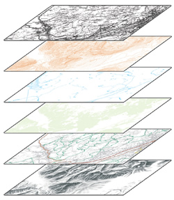
Structure of the Cartographic Model - Raster
The Cartographic Model - Raster (KM-R) is structured by means of the following topics:
- Situation
- Contour Lines
- Hydrography
- Forest
- Thematic Overprints
- Hill Shading
These topics are subsequently divided into several layers related to different colors (single files).
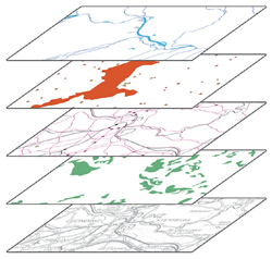
Structure of the Cartographic Model - Vektor
Similar to the Cartographic Model - Raster the Cartographic Model - Vector
(KM-V) is divided into different object ranges:
- Hydrography
- Boundaries
- Transportation
- Soil Cover, Vegetation
- Settlements, Individual Objects,
Geographical Names - Contour Lines, Hill shading
Updating
The Cartographic Models are updated in regular intervals (nationwide updating) and as required (continuous updating).
Nationwide Updating (FAKT)
This update aims at reviewing the whole content of the KM nationwide at regular intervals. The nationwide updating is based on the comparison of the existing KM with up-to-date areal images followed by revision in the field.
The nationwide updating is divided into units that correspond with the respective UTM sheets of the international reference system.
After every second nationwide updating of a map sheet (KM50) as well as after defined intervals (KM250, KM500) the respective Austrian Map is also published as a print version.
Continuous Updating (LAKT)
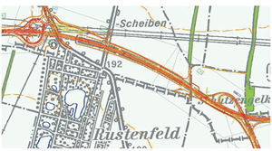
All especially important changes such as realignment of highways, roads and local bypasses, railways, big power plants, ski lifts and high-voltage lines, are implemented into the respective KM as soon as they have been built.
The updates do not necessarily go hand in hand with a new print version of the respective Austrian Map.
Notwithstanding the updating method the digital data will be available as soon as the building site is finished. They will be available as Cartographic Models at the BEV-Portal, in the AMap online and the AMap mobile.